What Is a Jet Stream and How It Affects Flights
By hello@indexsy.com
March 18, 2026
10 min read
When we think of flight, most of us picture planes soaring above the clouds, but few consider the invisible rivers of air that shape the journey: the jet streams. So, what is a jet stream? These high-speed currents of air are more than just a meteorological curiosity, they can influence weather, flight speed, and efficiency. Stretching across continents and oceans, the jet stream is a critical factor for pilots, airlines, and anyone tracking global weather patterns.
Whether a jet is flying from New York to London or Tokyo to Los Angeles, knowing the jet stream’s path can mean the difference between a swift, smooth ride and a bumpy, longer journey.
A jet stream is a narrow band of powerful winds that blows from west to east high in the upper troposphere, the layer of the atmosphere just below the stratosphere. These currents form along boundaries between cold polar air and warm air from the tropics, where temperature differences create a natural pressure gradient that pushes the air along at speeds that can reach hundreds of miles per hour.
There are two main types of jet streams: the polar jet stream and the subtropical jet stream. The polar jet forms closer to the poles, where cold air meets the warmer mid-latitude air, while the subtropical jet stream forms near the equator, where tropical air flows above the troposphere. Both play a key role in shaping weather systems and affecting weather across continents.
These air currents are not static; they meander along their paths, sometimes stretching far north or south, influencing air masses, weather patterns, and even severe winter weather events in the United States and beyond.
The formation of a jet stream is all about temperature differences. When cold polar air meets warm air from the equator, it creates a strong pressure gradient that drives a current of air across the planet. These narrow bands of strong wind flow from west to east across the northern and southern hemispheres, often reaching speeds of hundreds of miles per hour.
The polar jet stream is typically faster and more variable, forming along the polar front where colder air clashes with warmer air. In contrast, the subtropical jet stream is steadier, forming closer to mid-latitude weather zones. Both jet streams exist high in the upper troposphere, often shaping air masses and influencing weather systems across continents.
At times, these jets can meander, creating loops that push cold polar air farther south or allow warm air to move north. This movement has a direct impact on global weather, affecting weather events like severe winter weather or unusual temperature contrasts in different regions.
By understanding how these narrow bands of strong wind form, meteorologists and pilots can better anticipate their effects on both weather and aviation.
Jet streams, whether the polar jet stream or the subtropical jet stream, guide weather systems and determine how air masses move. Their influence stretches across the northern and southern hemispheres, shaping global weather and the weather in the United States.
Shifts in the polar jet stream allow cold polar air to push south or warm air to rise north, creating significant temperature contrasts. This movement directly affects the weather and can trigger severe winter weather in temperate regions.
The subtropical jet stream transports tropical air and water vapor, feeding storms and influencing mid-latitude weather patterns. Together with the polar jet stream, these narrow bands of strong wind help determine weather events like rainstorms, snow, and unusual heat waves.
Variations in the jet stream over the Pacific Ocean are linked to El Niño and La Niña, which can dramatically affect weather patterns worldwide. These currents influence cold polar air, warm air, and the polar vortex, impacting weather and climate across continents.
Understanding the position of the jet streams and how they blow from west to east across regions helps meteorologists forecast weather more accurately. Tools like weather satellites and weather balloons track these air currents to predict weather events and severe winter weather.
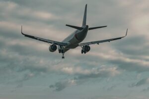
Pilots can fly with the jet stream to save time and fuel. The fastest winds along jet streams can increase a jet’s range and reduce travel time, while meanders in the stream can create turbulence that affects aircraft and passenger comfort. Understanding wind speed, jet stream location, and altitude is key to safe and efficient flight planning.
While jet streams are invisible to the eye, pilots feel their impact every day. Flying with a jet stream can significantly reduce flight times and fuel consumption, especially on long-haul routes where aircraft range and efficiency are critical. Tailwinds from the polar jet stream can increase a jet’s speed, while flying against it may add hours to a journey.
Turbulence is another consideration. The meandering polar and subtropical jet streams can create pockets of air current instability, which pilots navigate by adjusting altitude or changing flight paths. Airlines rely on real-time jet stream data, and companies like Bitlux provide the forecasts and analytics that help pilots plan the safest and most efficient routes. These high-altitude winds are a quiet but powerful partner in aviation, and leveraging expert data ensures both aircraft efficiency and passenger comfort.
Jet streams are not uniform; their paths vary between the northern hemisphere and the southern hemisphere. In the north, the polar jet stream drives cold polar air into mid-latitudes, influencing winter weather in the United States and Europe. The subtropical jet stream carries tropical air and moisture, affecting storms and precipitation patterns.
In the southern hemisphere, similar dynamics occur, but over oceans and southern continents. The polar night jet forms during extreme polar winters, moving arctic air across the polar regions, while the Atlantic jet and jet stream over the Pacific shape weather events and global climate patterns. Seasonal shifts in the position of the jet streams create loops and meanders, redistributing warm air and cold polar air across latitudes and impacting air currents worldwide.
Scientists and meteorologists rely on several tools to monitor jet streams and their influence on weather and flights. Weather satellites provide global coverage, showing the flow of air currents and the narrow bands of strong wind that form the polar and subtropical jet streams. Weather balloons offer precise data on wind speed, altitude, and air mass composition in the upper troposphere.
By tracking the location of the jet streams, forecasters can predict weather events, plan flight routes, and issue guidance for severe winter weather or storm systems. Understanding these high-speed currents of air helps both aviation and meteorology, making global weather and flight planning safer and more efficient.
The jet stream shapes both weather and aviation. These fast-moving air currents guide storms, influence temperature patterns, and help pilots fly with the wind to save time and fuel. By tracking their location and speed, meteorologists can forecast global weather, while airlines optimize flight range and capacity. Understanding the jet stream means predicting the weather and making every jet flight smoother, faster, and more efficient.